House Scan: an iPhone app for scanning a house with LiDAR and automating insurance documentation
A free, open-source iPhone app that scans a house into floor plans, a 3D model and an insurance inventory, how it was built with Claude Code, and what real scans taught us about Apple's RoomPlan.
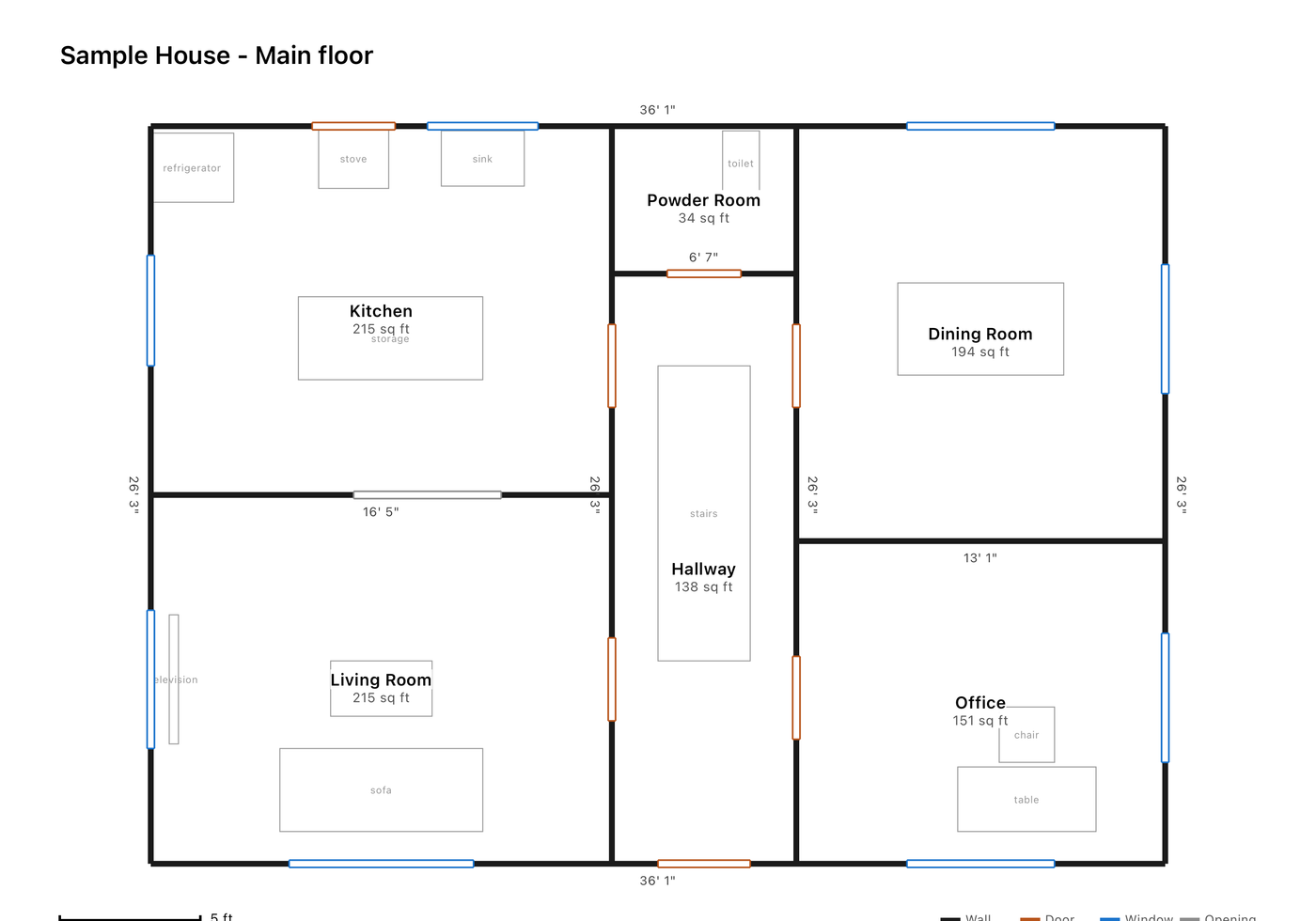
I wanted three things from one walk through my house with my phone: a floor plan of every level, a 3D model I could build on, and an insurance inventory that didn’t involve typing serial numbers. The apps I tried did one of these, wanted an account, or charged per export. So I described the app I wanted to Claude Code, and two hours later it was on my phone, and the next day every floor of the house was scanned. It’s called House Scan. It’s open source and free, with no account and no networking code at all.
The code is on GitHub under the MIT license, and I’m preparing an App Store version.
What it does
| Feature | What you get |
|---|---|
| Room scanning | Walk each room with a LiDAR iPhone. Apple’s RoomPlan framework finds walls, doors, windows, openings and furniture. |
| Floors | Rooms scanned in one session are merged into one floor with Apple’s StructureBuilder. |
| Exports | Per floor: a 3D model (USDZ), a PDF and PNG floor plan with measurements, and a JSON file describing every wall, door and window. |
| Insurance inventory | Items per room with photos, make, model, serial number and value, exported as a PDF. |
| Label scan | Photograph an appliance’s label and the item is added with its make, model and serial number read from the photo. |
| Site notes | Photos with a note, the location and the compass heading, exported as a spreadsheet. |
How it was built
I wrote a short brief: the stack (SwiftUI and RoomPlan), the structure (projects, floors, rooms), the exports, and a second phase for the inventory and site notes. Three constraints mattered more than the features. Verify on-device behaviour in Apple’s documentation rather than assuming it. Build with xcodebuild and tell me plainly what you couldn’t test. Don’t put my address or any real scan data in the repo.
Claude Code wrote the app, built it from the command line, and ran its tests on the simulator and then on my phone over the cable. The simulator can’t scan, so the tests use RoomPlan’s real types with invented rooms, and a separate set of device tests runs only on a LiDAR iPhone, against my real scans, printing counts rather than any geometry. My part was scanning, reporting what I saw, and making calls. One call was a correction: an early version said all data “stays on this iPhone.” That was Apple’s claim about how RoomPlan processes a scan, not mine, and it isn’t true of a phone backup or an export the user chooses to send. The app now says what it actually does, and its data is in normal iPhone backups.
By the end there were 87 unit tests and 4 UI flows, and a script that checks both the source and the built app for networking code.
What real scans taught us
Everything passed on the simulator. Real scans found the problems, and none of them is in Apple’s documentation.
| What happened | Why | What we did |
|---|---|---|
| The first save failed | RoomPlan’s raw scan data fails to encode with “Invalid data” on every real room. Apple’s developer forums report the same, with no answer. | Keep the processed room, which encodes fine, and drop the raw data. |
| Values that break JSON | RoomPlan can report NaN for a measurement, which JSON can’t hold and which crashes Swift’s integer conversion. | Write NaN as a string, and show “unknown” on the plan. |
| Invented test rooms crash on the phone | A room built from JSON lacks an internal floor-plan object RoomPlan expects, and on a device loading one crashes in a way the app can’t catch. | Device tests use real scans; invented rooms stay on the simulator. |
| Room names in the wrong place | Merging moves and rotates the whole floor, by several metres, and gives the rooms new identifiers. The walls keep theirs. | Place each room’s name by matching its walls. |
| A second merge fails | Rooms loaded from disk can only be merged once. | Reload them before every merge. |
| Plans printed at a slant | A scan’s axes come from wherever the phone started. | Turn each plan so most of its walls run square to the page. |
| A crooked garage wall | Storage in the way hid one corner, and the scanner guessed. | Hand corrections from tape measurements, kept separate from the scan. |
The main floor came out at about 2,250 square feet, past the 2,000 Apple recommends for one merge. Twelve rooms merged anyway.
Stacking the floors
Each floor is scanned on its own, and each scan’s coordinates start wherever the phone happened to be. So the floors don’t line up. Matching walls between floors settled the lower level, but for the upper floor two placements fit almost equally well. What settled it was a walkthrough video: I filmed a walk from the front door, through the garage, up one staircase and down the other. Claude pulled frames from it and turned what it saw into constraints. Stairs land on stairs, the door between the house and the garage lines up on both sides, and two named rooms sit over the garage. With those, the garage door matched to within 5 cm and both staircases to within about 1.4 m. The lower level’s patio door and windows then landed under the cantilevered kitchen without being told to, which is how I knew the fit was right.
The first picture of the result looked backwards to me. It was: the drawing had put the scan’s depth axis up the page, which mirrors a top view. The fit itself had been right.
Label scanning
Typing serial numbers is the reason most home inventories never get finished. In House Scan you photograph the label. Apple’s Vision framework reads the text and any barcodes on the phone, the app picks out the make, model and serial number, and the item is added with the photo attached. Every item added this way is marked to be checked until you open and save it, because labels put model and serial numbers side by side in ways that are easy to misread.
Privacy
The app has no account, no analytics and no networking code, which the build checks. Scanning and label reading use Apple frameworks that Apple says run on the device. Your data is in your normal iPhone backups, and an export leaves the app only when you share it. The privacy policy lists exactly what it stores.
Limitations
- Scanning needs an iPhone or iPad with LiDAR. The inventory works on any iPhone.
- Adding a room to a floor on a later visit depends on the phone recognizing the place from its saved map. For our garage it never did, so the garage became its own floor.
- Clutter makes walls wrong. The plan is approximate, so measure anything that matters by hand.
- The scan has no compass, so plans have no north arrow unless you add one.
What the scans became
The exports were the start. The same scans became a 3D blueprint of the house that works as a Home Assistant dashboard, with the room names and device controls drawn into the scene by html-in-canvas, a new web platform API. That’s the next article. They also gave Pond House, the sticker dollhouse game our kids play on our home hub, a version of our real house: its rooms, all three floors, the doors between them and both staircases.